In this premium blog post, we take a closer look at how Soviet maps visualized the landscape using standardized symbology. Discover how these cartographic conventions helped convey detailed information about the terrain, and how they allowed users to interpret maps effectively and consistently — even under the demanding conditions of wartime navigation.
Explore the world of Soviet topographic maps and their enduring legacy.

Topographic maps are essential tools for accurately representing terrain features. In the USSR, the system of topographic symbols was carefully developed to depict everything from rivers and settlements to roads and industrial facilities. These symbols were divided into three categories: scale (contour), non-scale, and explanatory signs — ensuring clarity and precision in cartographic data.
In preparing this material, we used the official system of topographic symbols issued by the Military Topographic Directorate of the General Staff of the USSR (1966 edition). However, it is important to note that most of the symbols had remained largely unchanged since the early 1940s.
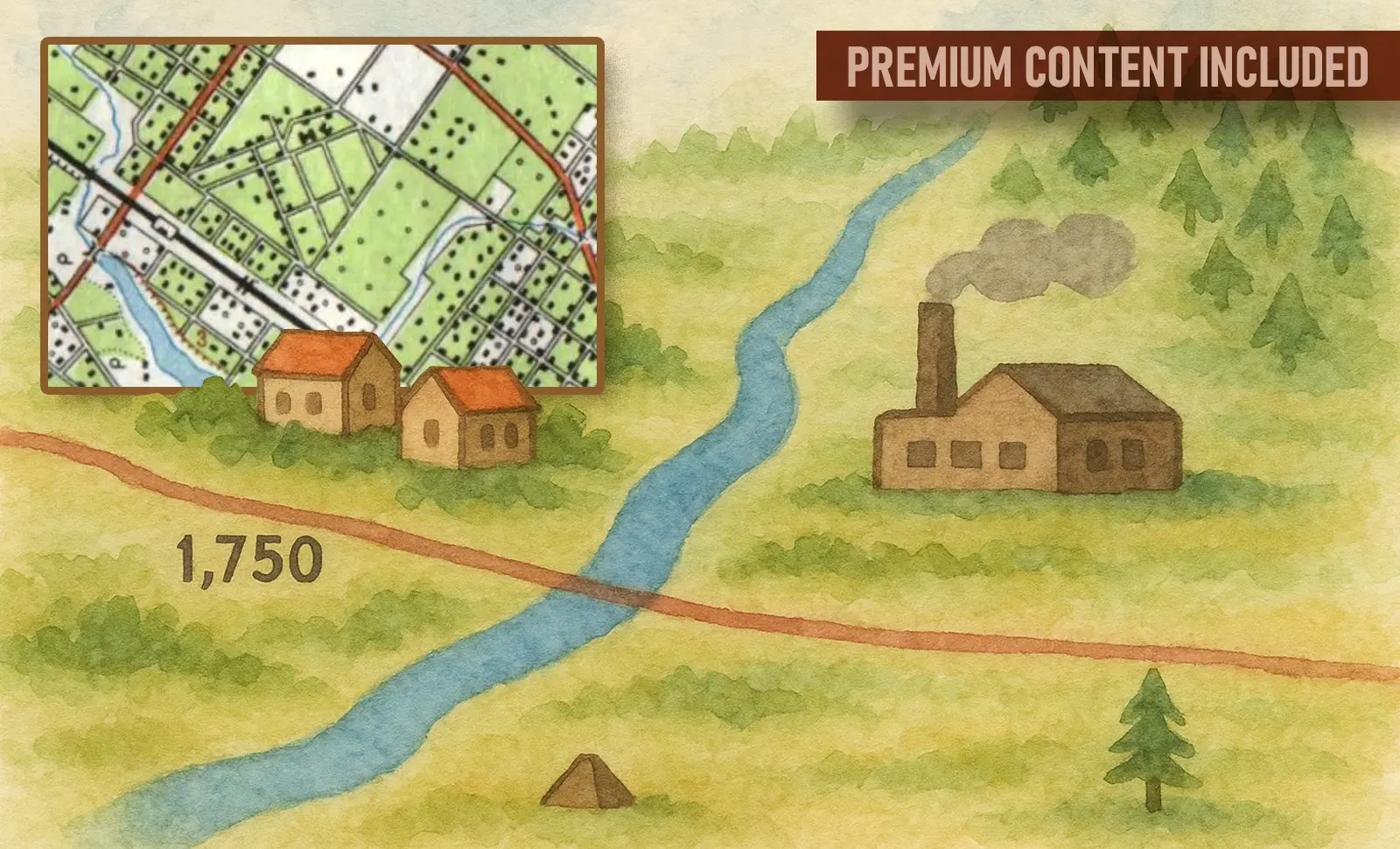
Conventional signs for maps at scales 1:25,000, 1:50,000 and 1:100,000
📁 Factory and industrial smokestacks


This symbol was used to indicate single or grouped smokestacks belonging to heavy and light industry enterprises. These symbols helped identify the presence of an industrial area on the map and served as important landmarks for navigation, especially when combined with railway junctions and factory buildings.

Designation of oil derrick (left) and gas derrick (right).
On Soviet topographic maps, different symbols were used to represent various mineral extraction facilities. Oil and gas derricks were marked with distinct symbols indicating the presence of both explored and active resource deposits.
These symbols not only denoted industrial infrastructure but also helped assess the strategic importance of a given area. Their presence was especially significant on maps of major oil and gas regions of the USSR, such as Western Siberia, the Volga region, and the Caucasus.
The symbols were applied depending on the map’s scale and the level of exploration — from individual derricks to entire extraction fields.
📁 Oil and gas derricks

📁 Radio and television masts


On Soviet topographic maps, tall engineering structures used for radio communication and television broadcasting were marked separately. Radio and television masts were represented by specific symbols indicating the presence of important communication facilities.
These structures were typically located on elevated terrain or near populated areas and often served as visual landmarks for navigation. Their depiction on the map helped identify the region’s technical infrastructure and assess potential radio coverage.
The symbols were used across various map scales and could be accompanied by labels indicating the mast’s height or purpose.

Soviet topographic maps featured a specific symbol to indicate permanent tower-type structures — tall, solid constructions with a fixed (stationary) purpose. These included water towers, observation towers, industrial towers, and other engineering facilities with vertical prominence and important functional roles.
Such structures were significant not only for infrastructure but also as navigation landmarks. Their depiction was especially important in flat or forested areas, where a tower could serve as a distant reference point.
These symbols appeared on topographic maps of various scales and were sometimes accompanied by clarifying labels, such as the height or the function of the object.
📁 Permanent Tower-Type Structures

📁 Light-Type Towers


Soviet topographic maps used specific symbols for light-type towers — temporary or lightweight structures such as geodetic, signal, forest observation, or construction towers.
These objects typically lacked permanent foundations and could be quickly erected or dismantled. Nevertheless, they played an important role in observation, communication, or navigation and were marked on maps as independent elements.
The symbol for such towers helped indicate the nature of the local infrastructure and the level of technical development in the area. It was especially common in regions with geodetic activity, forestry operations, or nearby construction sites.

25 and 15 – heights in meters.
Left: represented at map scale
Right: not represented at map scaleOn Soviet topographic maps, spoil tips, or terricons, were marked with a specific symbol. These are man-made mounds formed by the accumulation of waste rock during the extraction of minerals—most commonly coal.
These distinctive cone-shaped formations, often reaching several dozen meters in height, served as important landmarks and indicated the presence of mines or other extractive industries. In regions of intense mining activity, such as the Donbas, terricons were marked in large numbers, shaping entire industrial landscapes.
On maps, spoil tips were represented by a conventional symbol and could be accompanied by height notations. Their presence helped assess both the terrain and the industrial potential of the area.
📁 Spoil Tips (Terricons)

📁 Transformer Booths


Soviet topographic maps depicted not only large-scale energy infrastructure but also elements of local electrical networks. Transformer booths — small structures used to convert voltage in distribution systems — were marked with a dedicated symbol.
These booths were typically located near residential areas, rural settlements, industrial facilities, and along power lines. Despite their modest size, they played a crucial role in electricity supply and were therefore shown on medium- and large-scale maps.
The inclusion of transformer booths on maps made it possible to assess the level of infrastructural development in a given area and was useful for planning and navigation.
To be continued.
In the third part of this publication, we will continue to introduce you to the symbols used for individual local features on Soviet topographic maps.
Signs of the Terrain: Cartographic Symbols Collection


&url=https://not-toys.com/product/german-military-symbols-vol-2-discounted-copies-minor-defects/&media=https://not-toys.com/wp-content/uploads/2024/11/German-Military-Symbols-Vol2-800x800.webp)